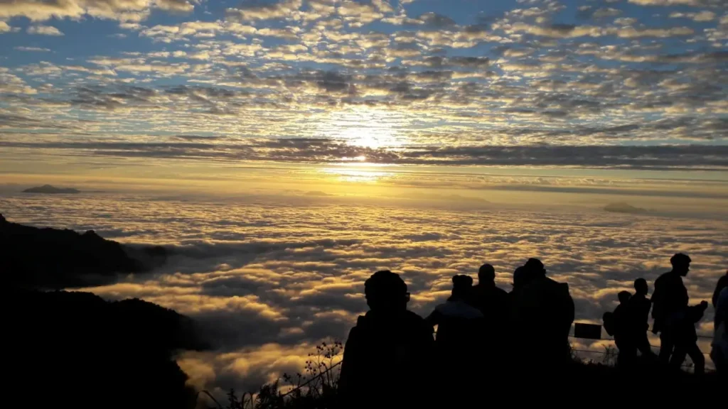
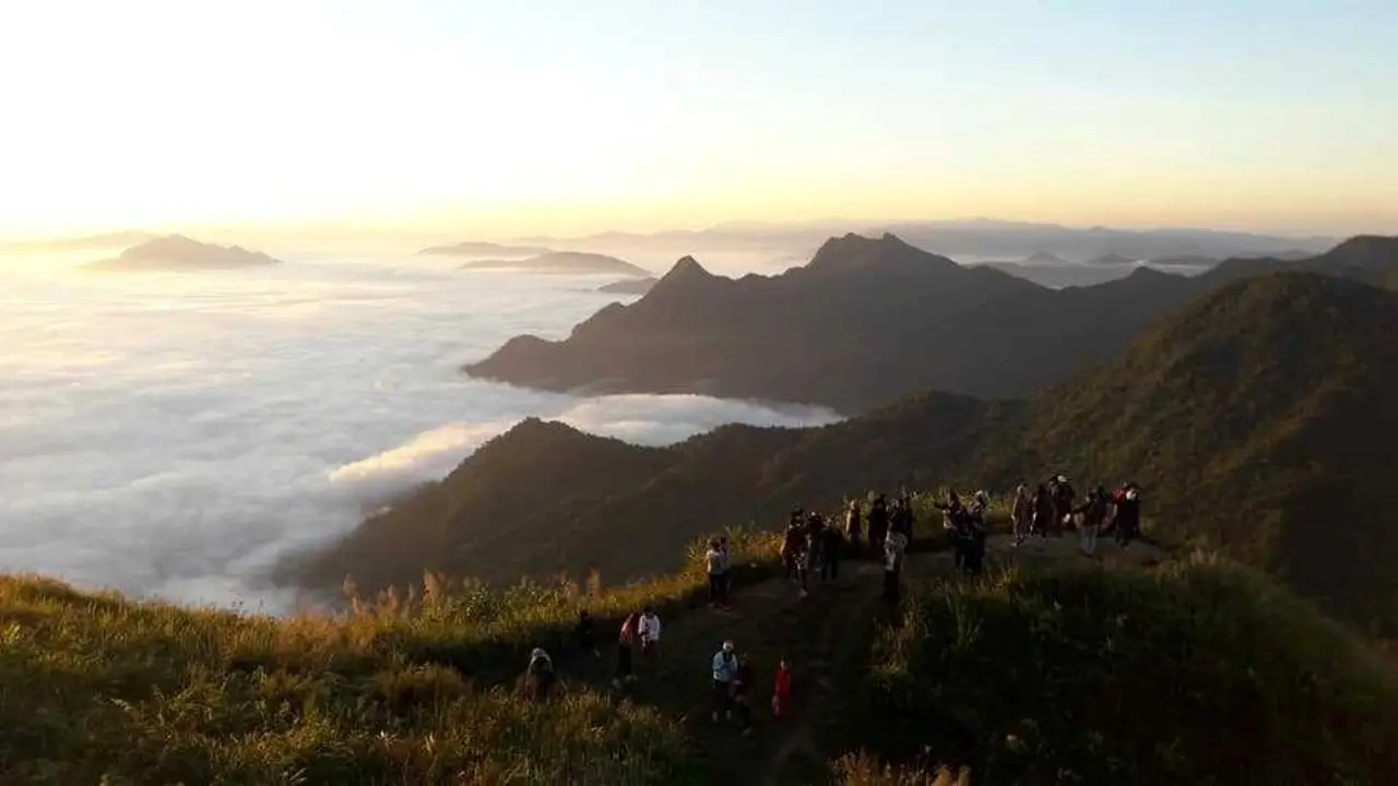
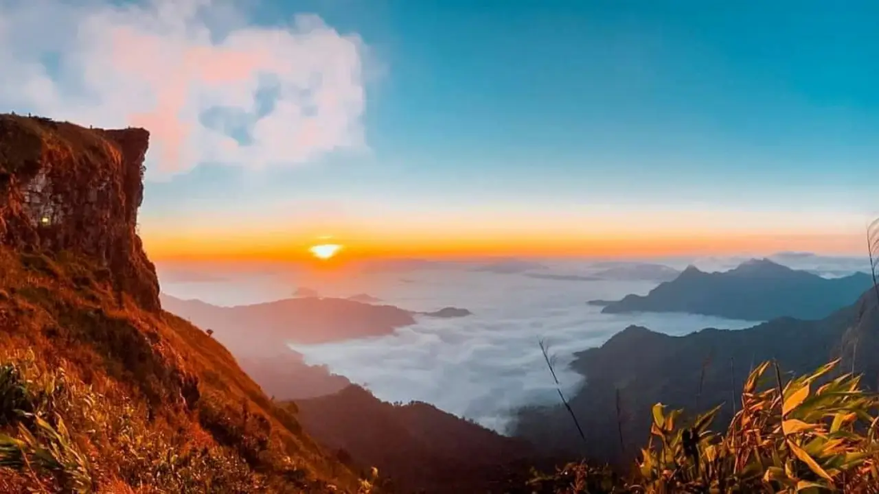
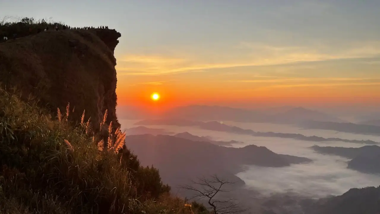
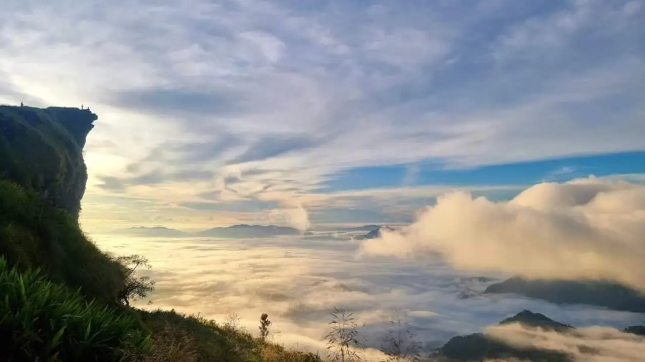
Phu Chi Fa is a high mountain peak offering panoramic views at an average altitude of 1,628 meters above sea level. To the east, it borders the Lao People’s Democratic Republic, with steep cliffs forming one of the most breathtaking viewpoints. From October to February, the scenery is particularly stunning, with spectacular views of sunrise, sunset, and a sea of mist.
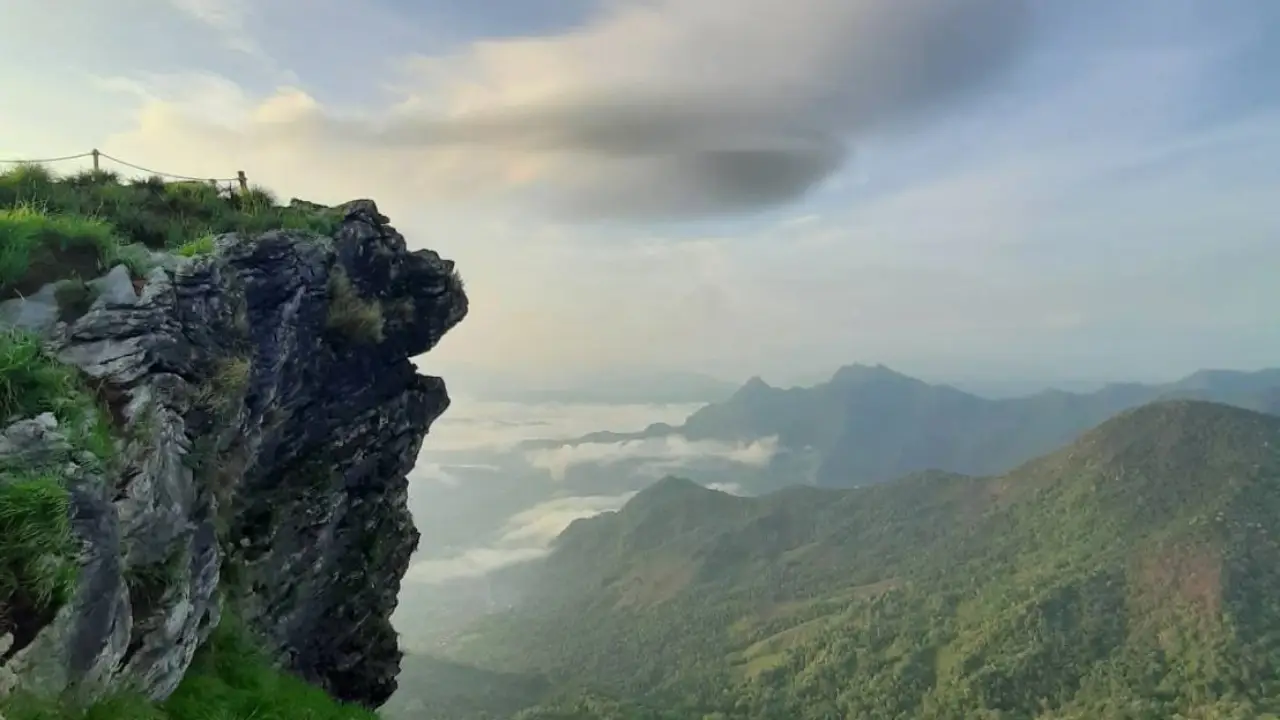
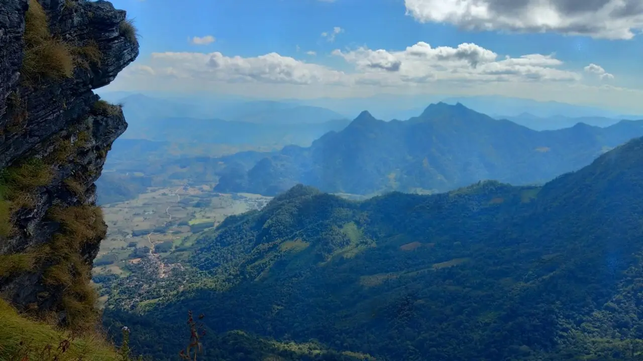
Phu Chi Fa is part of the Doi Pha Mon mountain range, forming a natural border between Thailand (Chiang Rai-Phayao) and Laos. It features a vertical rock cliff. In the past, it was an area of Communist Party of Thailand (CPT) activity. Due to its steep terrain, it served as a strategic stronghold.
Locals from both Thailand and Laos referred to the sharply rising rock cliff as “Phu Fa” (Mountain of the Sky). When political stability was restored, a road was built along the Thai-Lao border, connecting Ban Pha Tang, Phu Chi Fa, and Chiang Kham District. Since 1991, Phu Chi Fa has gained recognition as a popular tourist destination.